-
-
Smart Disaster AI

🌪️ Inspiration In a world where climate-related disasters are escalating, we saw the urgent need for a smarter way to detect and respond to events like floods and wildfires. Traditional methods often suffer from delays or limited coverage. Our inspiration was to build a real-time, AI-driven disaster detection and monitoring tool that could empower responders, decision-makers, and even everyday users — using the power of satellite data and AI.
💡 What it does Smart_Disaster_AI is a web-based platform that:
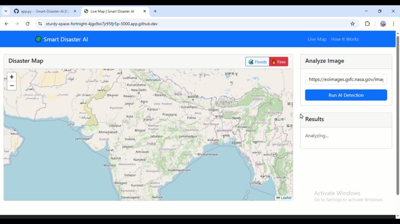
Detects flood and fire disasters from satellite imagery using AI.
Visualizes detection results on an interactive map via Leaflet.js.
Stores disaster data in a MongoDB Atlas database for future analysis.
Provides semantic search using sentence embeddings to find similar past events based on textual descriptions.
Supports real-time user input through image URL analysis.
🛠️ How we built it Frontend: HTML/CSS + JavaScript using Leaflet.js for mapping.
Backend: Built with Flask as the core API layer.
AI Model: Used a ResNet-50 classifier from Hugging Face for image-based disaster detection.
Geospatial Data: Fetched satellite imagery using Google Earth Engine (GEE).
Storage: Disaster records (type, location, confidence, image URL) are stored in MongoDB Atlas.
Vector Search: Implemented semantic similarity using Universal Sentence Encoder (USE) and MongoDB’s vector indexing.
🧩 Challenges we ran into Integrating multiple services (AI model, GEE, MongoDB) while keeping performance smooth.
Handling inconsistent or unclear image URLs during detection.
Deploying vector similarity in MongoDB took effort due to configuration complexity.
Working with limited or simulated data, especially for rare disaster samples.
🏆 Accomplishments that we're proud of Built a fully functional AI-powered disaster monitoring dashboard in just a few days.
Successfully integrated semantic search and real-time classification.
Made the tool scalable and generalizable for disasters beyond India (e.g., Europe, South America).
Created a clean, user-friendly UI that visualizes complex geospatial data.
📚 What we learned How to combine geospatial data and machine learning into a usable product.
The power of open-source models and APIs in accelerating development.
Gained hands-on experience in vector search and sentence embeddings.
Importance of usability and clear visualization when working with critical data.
🚀 What's next for Smart_Disaster_AI Integrate real-time satellite feeds via GEE Task Scheduler or APIs.
Expand the model to detect more disaster types: landslides, hurricanes, drought.
Add mobile support and notification systems (SMS, email, alerts).
Collaborate with NGOs and governments for real-world deployments.
Train our own domain-specific model using fine-tuned satellite data for even higher accuracy.
Built With
- css3
- flask
- googleeartengine
- html
- huggingface
- index
- javascript
- leaflet.js
- mongodb
- react
- tensorflowhub

Log in or sign up for Devpost to join the conversation.