-
-
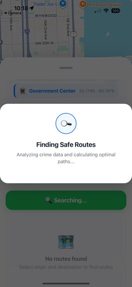
Loading Routes...
-
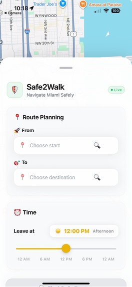
UI Interface with No Locations
-

UI Interface with Locations
-

Generated Routes
-
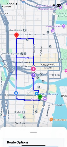
Routes Displayed on Map
-
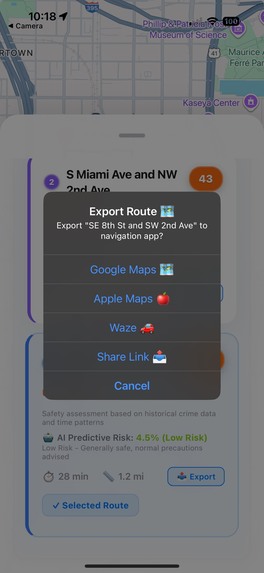
Exporting Route Pop-Up


Inspiration
As college students, all four of us have experienced the uneasiness of walking through certain areas, especially late at night or in unfamiliar neighborhoods. Safety is a constant concern, yet existing map applications rarely factor in how safe a route may be. We were inspired to create a tool that helps students and community members choose safer paths for walking, improving both transportation and overall well-being. Our goal was to design something practical that we ourselves would use every day on campus and in surrounding areas.
What it does
Our application allows users to input a destination and receive multiple possible walking routes. Each route is assigned a safety score and a predicted risk percentage, generated using our Random Forest AI model. Users can compare routes based not only on distance and time but also on how safe they are likely to be. Once a route is selected, the app exports directly into Google Maps, allowing users to navigate with turn-by-turn directions while knowing they’ve chosen the safest available path.
How we built it
We built our project using React Native with Expo for the frontend, creating a smooth and accessible mobile app interface. For the backend, we used Python with Flask to handle API calls and connect to our machine learning model. We incorporated various Google APIs to gather real-time data for routing and location context. Together, this stack allowed us to build an application that could predict a safety score for a route and then export the chosen path into Google Maps for navigation.
Challenges we ran into
One of the biggest challenges was connecting our backend and frontend reliably. We ran into issues with how API calls were being made and how to return structured data about routes. Another challenge was designing a mathematical approach for calculating safety scores and then integrating our AI model to predict risk percentages. Balancing simplicity for an MVP with the complexity of handling real-world data also required careful decisions. Despite the hurdles, we managed to create a working prototype that addressed our original inspiration.
Accomplishments that we're proud of
We are proud of how well we came together as a team, helping each other debug issues and push through difficult moments. We are especially proud of the formulas we developed to generate safety and risk scores, which combined both mathematical reasoning and machine learning. Finally, we are proud of how polished our app looks, integrating seamlessly with Google Maps to provide a familiar navigation experience while adding a completely new safety layer.
What we learned
Throughout this project, we learned how to better collaborate as a team under time constraints. We gained experience resolving merge conflicts, splitting up tasks effectively, and making fast decisions. On the technical side, we learned how to integrate an AI model into a full-stack application to generate predictive risk scores. For some of us, this was also the first time building a mobile app, so we had to quickly adapt to working with React Native and Expo. Overall, we came away with both stronger technical skills and improved teamwork.
What's next for Safe2Walk
Right now, our app is built with Miami in mind, where many students like us rely on walking to get around. But our vision is to expand this tool to cities across the United States, where safety concerns vary from campus neighborhoods to downtown areas. In the future, we hope to incorporate more real-time data sources, expand our machine learning models to consider additional factors, and create a broader platform that promotes wellness and security for anyone traveling on foot.


Log in or sign up for Devpost to join the conversation.