-
-
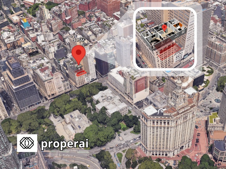
Main page
-
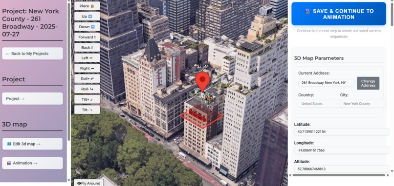
Interface
-
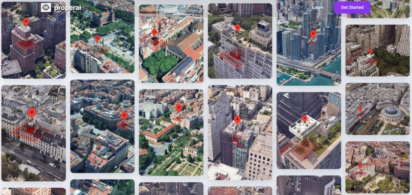
Projects gallery
-
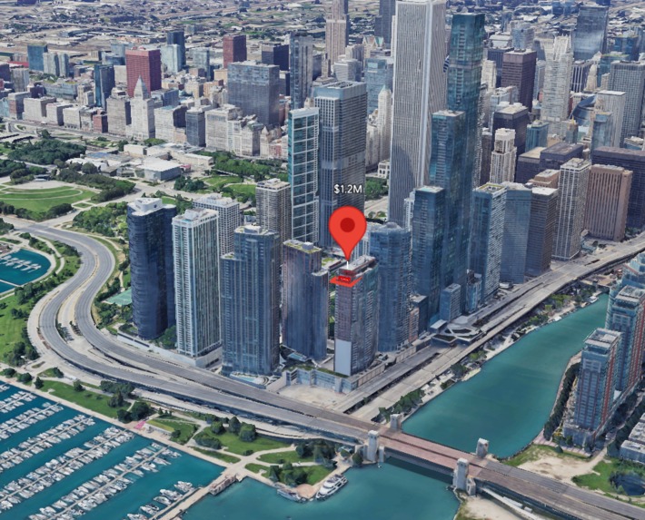
Example - Chicago
-
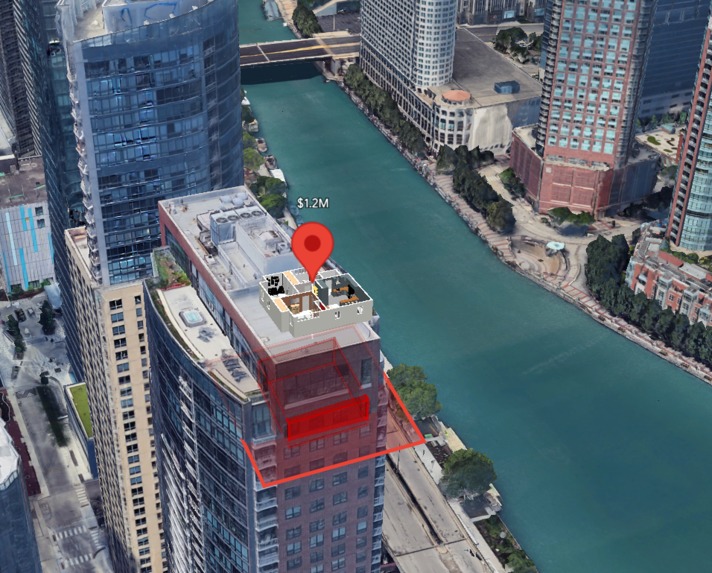
Example - Chicago
-
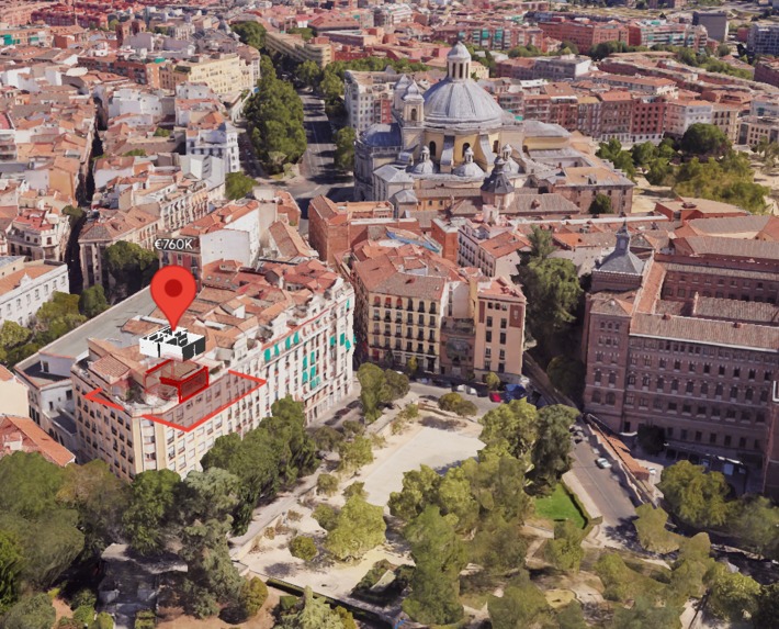
Example - Madrid
-
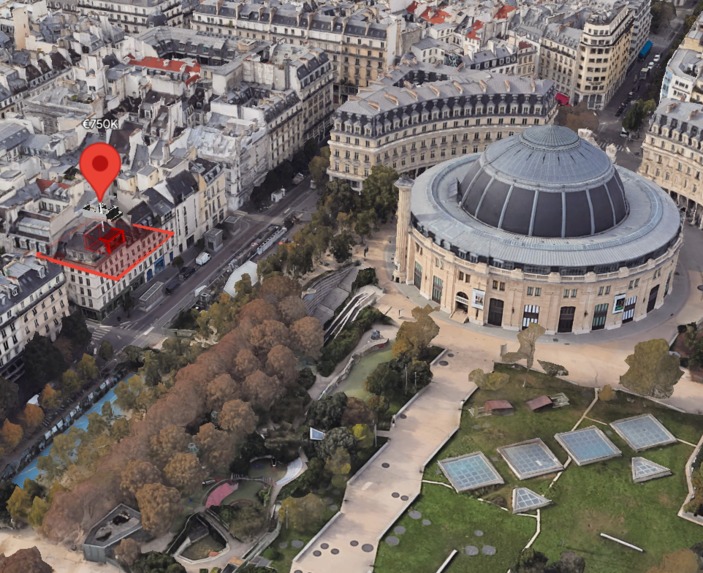
Example - Paris
-
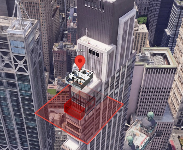
Example - New York


Inspiration
Almost 15 years ago, I helped my parents search for an apartment for the first time. Since then, I've always enjoyed property searching. Moreover, I've remained in this field professionally, having worked as a BIM coordinator at a development company. Over the years, I've seen many approaches to real estate listings, and to me, location and view are the most important factors. When Google released WebGL-powered maps features for the Maps JavaScript API, I had an idea immediately.
What it does
properai lets real estate agents upload a 3d model of an apartment in .glb format or use a placeholder cube instead. With control buttons, they can place this model in the exact location on a real-world 3d map and create stunning visuals of surrounding context.
How we built it
I started building it when photorealistic 3d map didn't exist - only basic forms using the Maps Javascript API. I put the project on hold until Google released photorealistic 3d tiles, which inspired me to give it a second chance. Over the past 6 month I've dedicated most of my my free time to this project, teaching myself web development and exploring new technologies. With the help of AI coding tools, the development process accelerated.
Challenges we ran into
- Perfomance issues on low-end PCs
- Rotating polygons was technically challenging
Accomplishments that we're proud of
- Implementing a rotating highlight polygon that aligns with the 3D model using a custom formula
- Tracking usage metrics
- Creating a seamless experience placing 3D models in real-world map
What we learned
Starting as non-developer, I learned the basics of web development from scratch. More importantly, I discovered just how powerful and diverse Google's APIs are. Every time I think of a new feature or idea, there's already an API for it - it is like Google has one for evertything. It is really cool.
What's next for properai
- Simplify 3D model creation by automatically generating apartment models from 2D plans
- Add a GLB processor to automatically adjust the model's bounding box
- Implement auto-positioning based on street direction
Another possible direction (or even a separate product): I want to build an interactive 3D map for better property desicion-making. This would help buyers become more aware of new developments, legal constraints and environmental risks in an area. Today, this information exists - but only in complex maps and dense documents. I want to make it simple and accessible. Imagine seeing at a glance:
- Are there any planned construction nearby in the next 5-10 years?
- Is there any risk of gentrification or demolition?
- Are there any industrial sites nearby that could affect air quality or create unpleasent smells?
All this, visualized in an intuitive 3D interface, so buyers feel like they've known the neighbothood for years.

Log in or sign up for Devpost to join the conversation.